Buckle in – it’s a long one!
September 19 – 22 – After a camping trip at Killarney Provincial Park with friends fell through, a co-worker suggested that we try Massasauga Provincial Park. Massasauga had a lot of benefits – it was closer to home, had a variety of backcountry sites and canoe rentals were available at the park entrance. So up the 400 we headed!
Day 1 – Although we always try our best to pack the night before it always seems that we have a few last minute additions to our packs. By the time we had made it through the Tim Hortons drive-thru (a pre-camping tradition of ours) it was almost 9 am, definitely not our fastest start to the day. The drive north was fairly uneventful. Toby dozed in the backseat, while his personal chauffeurs noted the trees changing colour and made last minute travel decisions. It was just after lunch when we arrived at Oastler Lake Provincial Park to pick up our canoe and register our campsites.
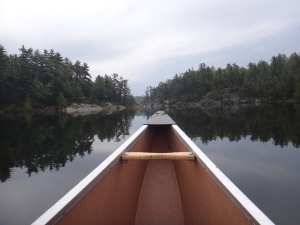
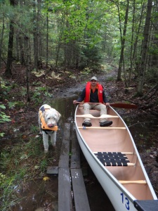
The Three Legged Lake Access Point was a 20 minute bumpy ride from the park office, at last we were ready to hit the open water! With the car safely stowed in the parking lot, our canoe packed with the essentials and everyone securely in their lifejackets, we pushed off from the dock.
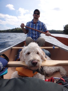 The sun was shining as we glided across the lake. Toby switched between sitting up to feel the wind through his fur and laying in the bottom of the canoe. Maybe we were gliding a little too quickly, maybe we were distracted by the many beautiful and quaint cottages or maybe we just cannot read a map to save our lives but before long we had reached the north end of Three Legged Lake, not where we were planned to be. We spun around and headed back to where we were supposed to portage into Spider Lake. Thankfully the portage was easy to find, we quickly moved our canoe and gear and had a snack (homemade beef jerky!). We met two other paddlers who were very familiar with the park and gave us some advice and told us about a shortcut.
We completed another short portage, this time into a very narrow passage. Back on open water we were determined not to make another navigation mistake so with a map and GPS (which we soon learned was next to useless) we headed to our first stop, Site 111.
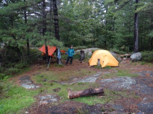
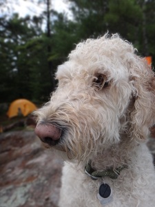
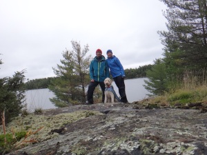
 Upon arrival we scouted the area for the best space for our tent, tarp and bear hang. We knew the weather the next day was not going to be great so we set the tarp over our picnic table (a luxury we are not always used to) and tried to find a protected spot for our tent. We decided to set up our bear hang before dinner, to save ourselves from trying to do it in the dark. While scouting for small rocks to use as a weight Toby stumbled upon a bees nest. The next 30 minutes are a blur as both Toby and I had to be de-bee-d. The bees clung to my fleece and Toby’s fur. Thankfully we had packed our leatherman and one by one the bees were removed and Toby and I went down to the water to soak our wounds.
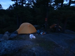
Exhausted from the canoeing and bee attack we set the bear hang and ate our tinfoil dinners. The sky was dark when we hoisted our food. As our bag was slowly lifted in the air there was a snap and then a thud as the bag hit the ground. The rope had broken and so had our excitement to camp. But we persevered. After retying the rope and setting the bear hang for the second time, we held our breath as the bag was hoisted in the air, it held.
Back at the tent we watched the stars and remembered why we love camping. Toby settled down on his fleece blanket and we fell asleep thinking that the trip could only get better from here.
Toby’s exhausting 18.6 kilometre canoe trip can be viewed at Spider Lake Canoe.
 Day 2 – Before we were even out of the tent we knew if would be an interesting day. The Weather Network had been calling for anywhere between 15 – 40 mm of rain and wind. The sky was dark as we cooked breakfast (scrambled eggs, our first time bringing fresh eggs). Just as we finished loading the canoe it began to rain. We covered our packs and Toby with our tarp and headed out.
The rain was constant and the wind was picking up. A last minute change to our route had us travelling through a narrow channel, instead of venturing out to Georgian Bay – a very smart and safe decision. After seeing a flash of lightening we looked for the first available spot to pull off and get out of the water. We found an empty campsite and set up our tarp over the picnic table and once again discussed changing our plans. After waiting for 30 minutes the rain began to die down a little and we could hear voices coming from the spot we had stowed our canoe. Toby went to investigate, the rightful ‘owners’ of the site had arrived and after a gruelling journey through Georgian Bay they were ready to claim their spot.
With the rain slowing we quickly jumped back in the canoe and headed for the portage. Before we had even finished moving our canoe the sky opened up again and we huddled under or tarp near the edge of Clear Bay. As Toby, the soaking wet goldendoodle, snuggled against us under our makeshift shelter, once again we questioned “why do we do this?”
 Another break in the rain and we paddled as fast as we could to Site 202. We were disappointed with what we saw – a site, which is likely beautiful in the sunshine, was completely under water. Once again we went about setting up our tarp, tent and bear hang. We were soaked, Toby was soaked, our bags were soaked. We peeled out of our wet and muddy clothing and laid out on our sleeping mats to dry. After having a short nap and playing some cards we emerged from our tent to see a grey sky but no rain! For dinner we cooked pasta and and explored our site a little more. Toby was finally looking a little happier and even though our gear was soaked, we were warm and dry and dare I say feeling a little proud of ourselves for completing this much our journey.
We fell asleep that night positive that the weather would be better the next day and excited to finish another leg of our adventure.
Toby’s soaking wet 6.8 kilometre canoe trip had to be broken down into three parts (thanks a lot rain!) and can be viewed at Spider Lake Canoe Part 2, Goose Neck Bay Canoe and Clear Bay Canoe.
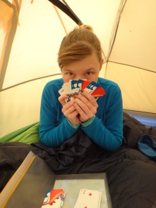 Day 3 – By this point we concluded that somehow we had angered the rain gods. It rained so hard in the night the tent was shaking and was splashed with mud. But the rain didn’t stop there. It rained, and rained, and rained. By 11 am we were going stir crazy. We hadn’t eaten, we hadn’t visited the thunder box and we had played so many hands of euchre and crazy eights I never want to see a card again in my life. Toby looked miserable. But we were dry. What was waiting for us outside was definitely wet. We waited another half hour before realizing that the rain was not going to stop and finally pulled on our rain gear to start our morning.
 After eating some soggy pancakes (to be fair the pancakes weren’t soggy, just the people eating them) and getting in touch with the park office to book the site for another night, we settled in for a few more games of cards under our tarp.
At some point in the afternoon the rain stopped and we decided to canoe around Cow Island. We could hear water pouring from the rock, creating small waterfalls as we canoed around the island. The rain held off for a short hike around our site and then we were ready for dinner. Our dinner that night was Backcountry Thanksgiving and even Toby got to enjoy some leftovers. This meal is now becoming our traditional last dinner while camping.
Once again we went to sleep thinking that there could not possibly be any rain left and tomorrow would be nothing but sunshine.
 Day 4 – Finally the weather agreed with us and we packed our site with the sun on our backs. We had a long way to travel that day to make up for Sunday, so after eating our oatmeal we were out of the water.
 The day before we had scouted out our next portage so for the first time we felt like we knew exactly where we were going. Once again we had to alter our route a little, opting for one large portage instead of multiple short portages. The first portage was extremely muddy and had such large puddles we thought might had to jump back in the canoe to make it to the other side. We were back in Spider Lake in no time and making great time. We stopped to talk to another paddler who also had a dog with him. Toby was very controlled and did not bark or wobble the canoe while meeting his new furry friend.
We battled some wind as we started to head back into familiar territory. We also started to pass more canoes on their way out to camp and learned that the road we had taken to the Access Point the previous Friday had been washed out in the rain. Our arms were beginning to tire as we completed our final portage into Three Legged Lake and we knew we were in the final stretch.
 Arriving at the Access Point was a great feeling – travelling almost 50 km, surviving a bee attack (ok surviving might be a bit of a stretch), enduring days of rain (we later learned over 50 mm!) and now we were headed home.
Toby’s 18.9 kilometre canoe trip can be viewed at Spider Lake Canoe Part 3.
This trip we questioned many times why we camp – to get dirty, wet, stung, hurt and exhausted? Unfortunately sometimes that comes with the feeling of accomplishment, the need for adventure and the desire to be with nature. Until next time – happy camping!
Posted in
Camping,
Canoeing and tagged
camping,
camping adventures,
canoe,
canoeing,
georgian bay,
goldendoodle,
hiking,
massasauga,
massasauga provincial park,
nature,
ontario parks,
outdoors,
provincial park |
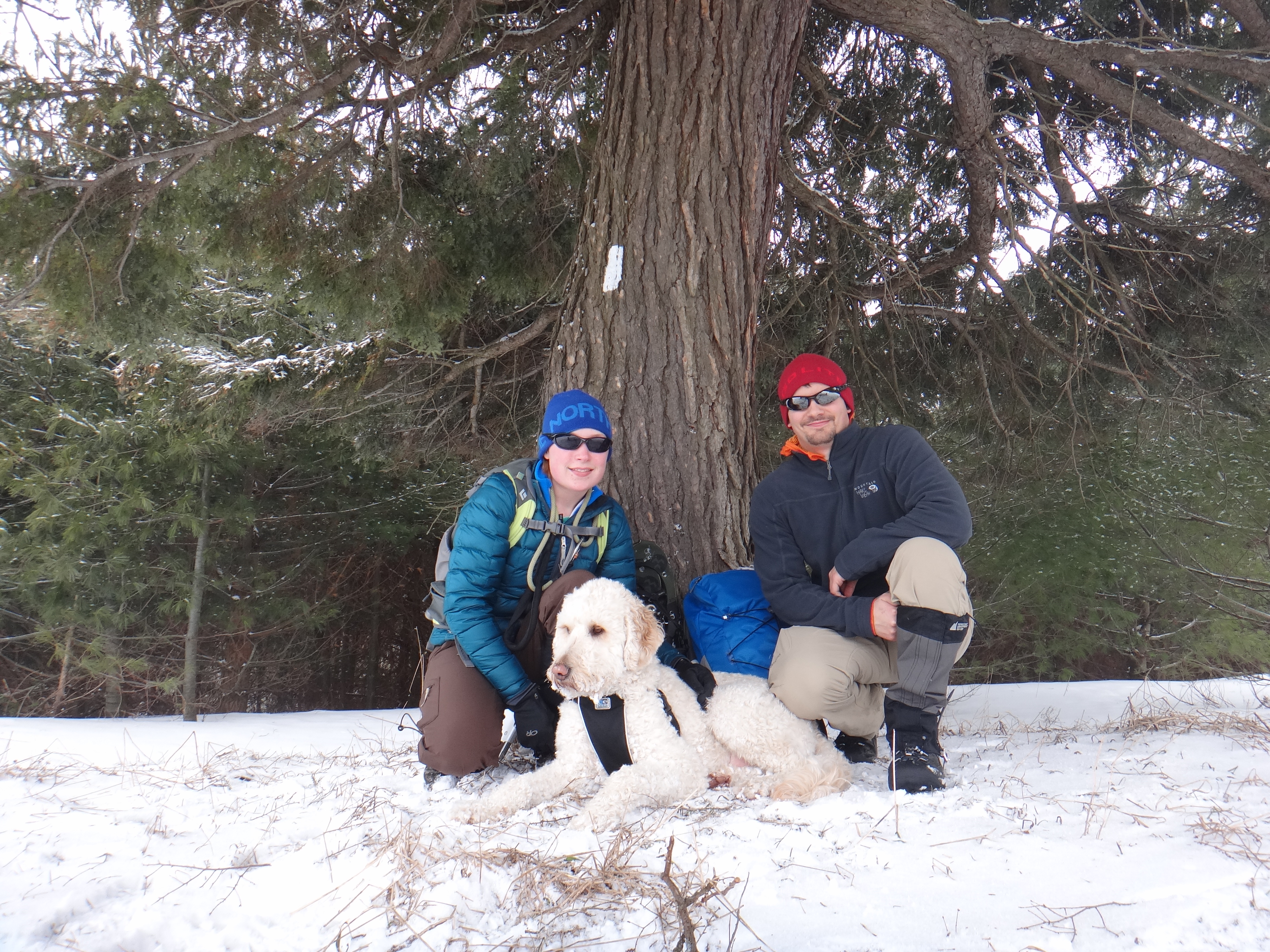
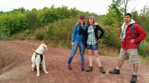
 October 12 – Happy Thanksgiving! After a BIG dinner we were ready for a BIG hike. Plus we were finally going to finish a section of trail that we had been putting off for ages.
 There was substantial flooding across the road from beaver dams, a few of us managed to keep our feet dry but of course Toby plowed straight through. The effect of the overflowing marshland was breathtaking.
 After a few minutes we realized the beagle was still with us (although usually rooting around in the tall grass). We nicely told her to “go home” – apparently not a command she understood because she kept walking with us, usually a few paces ahead but constantly checking pack to make sure we were in tow. After a while we realized that she knew the area pretty well and if she completed the hike with us, we would return her home afterwards. We even named her Barbie (at first she was Bob – but then realized our mistake).
 As we neared the point where the trail enters the bush we wondered if Barbie would keep walking with us. We didn’t have long to ponder this question as a pick up truck pulled up next to us and opened the door. There was no question that this was Barbie’s human as she jumped onto the seat next to him. After speaking to Barbie’s human we learned that she is quite the adventurer and has hiked to Dyer’s Bay many times and has even made it as far as Tobermory! As Toby bid adieu to his new friend, we has one final question, “what is her name?” The owner laughed and said – “Chase”.
 With our group now down a member we entered the bush and prepared ourselves for the more difficult trail. Although the terrain was rougher than the road, it was still not the most difficult hike we had completed. Once again the views of Georgian Bay were amazing and the sound of leaves crunching under our boots and the smell of fall gave a feeling of tranquility.

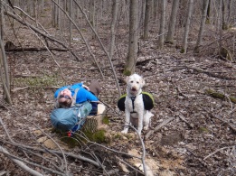
 Toby of course managed to find every burr bush in existence and we had to slow down to remove a few of the more painful patches. We stopped to view a small creek and waterfall and marvel at the rock formations.


 With no extraterrestrials in sight we explored the edge of the area. We weren’t there long before it started to lightly rain. The wet, red soil gave Toby little pink feet. As the rain came down harder we decided it was time to head back to the car.